
Walking a Frisco Street by Address
Frisco is split between Collin and Denton Counties, so a street-directory search begins by identifying a Frisco parcel's county rather than relying on its mailing city. The matching appraisal district supplies the working Frisco parcel key. For Collin, that is a property or geographic ID; for Denton, retain the property ID or X-Ref with the owner, property location, and lot or subdivision details. The property location is the situs, meaning the Frisco land being appraised. A mailing address is where tax correspondence goes and can be somewhere else. Neither field, by itself, identifies every person at an address.
Move in a fixed order. Each source answers a narrower question, which is more reliable than turning a list of names into a claim about a household.
- Find the address in the matching county appraisal search. Save the Frisco parcel or property ID, legal description, situs, mailing address, subdivision, block, lot, and tax year.
- Open Frisco or county GIS and compare the Frisco parcel geometry, road, city line, 911 address point, and nearby parcels. Maps are informational, not legal surveys.
- Carry the legal description and owner name into the county clerk land index for the Frisco parcel. The recorded deed, not the appraisal card, establishes a recorded transfer.
- Check Frisco eTRAKiT only for Frisco project timing and the public permit details associated with that site. A permit contact is not proof that a person occupies the property.
- For a registered-voter question, use the correct county's limited official path and apply the confidentiality and use rules. For a past Frisco address clue, ask the library or archive about reverse and criss-cross material.
For a whole-road search, record parcels one at a time. A street-name result can include duplicate road names, a subdivision road, or entries without a street number. Corner parcels deserve an extra comparison between the CAD situs, GIS point, and permit result.
Frisco Street Records Start by County
The county boundary controls the clerk, appraisal district, GIS context, and voter registrar. Collin County property goes to Collin Central Appraisal District Property Search and the Collin County Clerk. Denton-side Frisco property belongs with Denton CAD and the Denton County Clerk. Denton CAD's current direct search endpoint was not located in the research, so its documented fallback is the CAD office or the Denton tax and GIS records for a Frisco cross-reference. Denton tax search distinguishes Owner Address from Property Location and advises omitting street type and direction when searching.
Frisco's postal label does not settle the issue. Municipal jurisdiction, county custodian, appraisal district, legal description, and USPS mailing information can differ for the same Frisco property. That is why a Frisco address should be checked in the Frisco parcel record before a deed or voter search begins. The county GIS layers for Frisco add city and county limits, roads, precincts, and service districts to the comparison.
Note: A Frisco mailing address is useful for mail, but it does not choose the county office that keeps the underlying parcel record.
Frisco CAD Fields Along a Street
Collin CAD is the main Frisco street-search interface on the Collin side. Its current Frisco search advises using a simple street name, with no prefix, suffix, or unit number, when a full address does not return a match. Owner names are stored last name first name, and wildcard searching is available on the legacy interface for Frisco. The fields below are the published controls that matter most when tracing a road through a subdivision rather than looking for one exact house.
| Collin CAD field | Type | Use by street | Format note |
|---|---|---|---|
| Property ID | Text | Returns one known Frisco appraisal account | Numeric exact match |
| Geographic ID | Text | Links a Frisco map or parcel record to CAD | Usually 13-18 alphanumeric characters |
| Street # and Street Name | Text | Finds a Frisco address or road segment | Street search omits suffix in the legacy form |
| Owner Name | Text | Checks the displayed Frisco appraisal owner | Stored last name first; wildcard allowed |
| Abstract/Subdivision and Block | Text | Narrows similar streets in Frisco planned areas | Subdivision code/name and block are optional |
| Tract / Lot and Tax Year | Text or dropdown | Confirms the Frisco parcel version being reviewed | Optional fields |
The current Frisco search also exposes owner, street number, property type, agent ID, Doing Business As, street name, subdivision, condo, neighborhood, legal description, geographic ID, and tax-year controls. CAD says its legal descriptions and acreage are for appraisal use, so use the clerk's recorded instrument or plat when a legal conclusion about a Frisco parcel matters.
- Parcel
- A mapped unit of land in the appraisal system, identified by a property or geographic ID.
- Situs address
- The location of the land or building being appraised. It can differ from the owner's mailing address.
- Plat
- A recorded map that lays out a subdivision, lot, block, easement, or replat.
- Criss-cross directory
- An address-ordered directory that may offer a historic occupant or telephone clue when an archive actually holds the volume.
Frisco GIS for Street-by-Street Context
Frisco's public MapServer provides Frisco parcel context after the appraisal search. Its listed Frisco layers include OwnerParcel, BuildingFootprint, Cemetery, RoadCenterline, Railroad, parks, trails, water, and administrative lines. The service documents Frisco identify and query functions and JSON, GeoJSON, and PBF outputs. Its maximum selection or record count is 2,000, so a long Frisco street should be divided by segment, subdivision, or parcel range instead of treated as one complete result set.
The Frisco Community Maps service shows the public layers available for parcel-by-parcel context.
The Collin CAD Property Search below shows the address and advanced-property controls used for the Collin-side Frisco address trail.
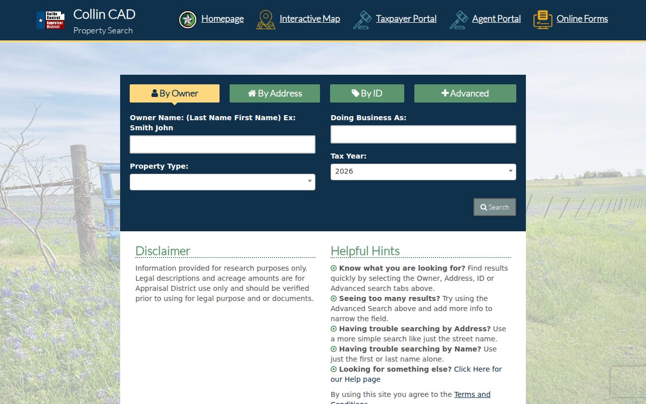
The Frisco CAD search screen is useful for turning a Frisco street and number into a Frisco appraisal record before comparing it with map geometry and a legal-description search.
Denton Landmark offers parallel layers for Frisco roads, 911 addresses, city limits, fire districts, political boundaries, floodplain, transportation, and voter precincts. Both GIS systems caution that their maps are informational rather than boundary surveys. Use the displayed Frisco parcel facts as a research trail, then verify a disputed lot line with the formal record.
Frisco Mailing and Situs Addresses
Address fields serve different functions. The CAD situs or Denton tax Property Location keys Frisco land, Frisco permits, and Frisco map layers. The Frisco owner mailing address is the tax-notice destination and may point outside Frisco or to an entity that owns several parcels. The Frisco legal description keys deeds and plats. A Frisco 911 address supports emergency and GIS location layers, while a ZIP handles mail delivery. Treating these as one field produces false matches, especially across the Frisco county line.
The owner label also has limits. A parcel can be held by a person, trust, estate, or business entity. A homestead or other exemption is tax-treatment information, not a public certification of present occupancy. If a corporate owner appears, preserve the parcel and deed details rather than guessing who lives at the site. For a condo, apartment, or manufactured-home record, check the unit or lot fields separately because the land and the individual unit may be indexed differently.
Frisco Address Records and Their Reach
A Frisco address directory draws from several Frisco address-keyed records, but none is a complete household register. The table separates what each Frisco source can show from what it cannot establish. Keep the county, source date, parcel key, and legal description with every Frisco result. That small record of method makes it possible to revisit a changed map or a corrected appraisal account.
| Address record | Keeper | What it can show | Access and limit |
|---|---|---|---|
| Frisco appraisal parcel | Collin or Denton CAD | Owner, situs, mailing address, legal description, subdivision, lot/block, and tax year | Online current search; owner is not every occupant |
| Frisco GIS parcel | County GIS or Frisco GIS | Geometry, roads, nearby parcels, limits, and public layers | Interactive map; not a legal survey |
| Frisco deed or plat | County Clerk | Grantor, grantee, transfer date, legal description, plats, easements, and liens | Collin historical/current split; Denton search and download rules apply |
| Frisco permit | Frisco eTRAKiT | Project number, site, status, dates, APN, lot/block, contacts, inspections, and fees | Public current system; not a residency list |
| Frisco voter record | County Elections | Registration information within statutory fields | Collin request or search paths; confidentiality and use restrictions |
| Frisco reverse directory | Library or archive | Historic address-to-occupant or telephone clue | Exact Frisco run was not located; ask the repository |
Frisco CAD supplies the Frisco parcel key, Frisco GIS supplies the spatial relationship, a deed or plat supplies the legal lot, and Frisco eTRAKiT supplies project timing. A Frisco voter result, when lawfully available, is a registration record. A Frisco historic directory is a dated clue. These Frisco sources should stay in separate columns until the primary records independently connect them.
Frisco Permit History by Address
Frisco eTRAKiT is a supporting Frisco address record. Its public search uses Search By, Search Operator, and Search Value. A result can show a permit number and type, site APN, subdivision, tract, block, lot, Frisco project status, applied and finaled dates, contacts, fees, inspections, reviews, and linked activities. Those fields can help date construction or a later Frisco change. They do not establish who lived at the property.
The Frisco eTRAKiT permit record illustrates the public address, APN, lot, date, status, contact, inspection, and review fields.
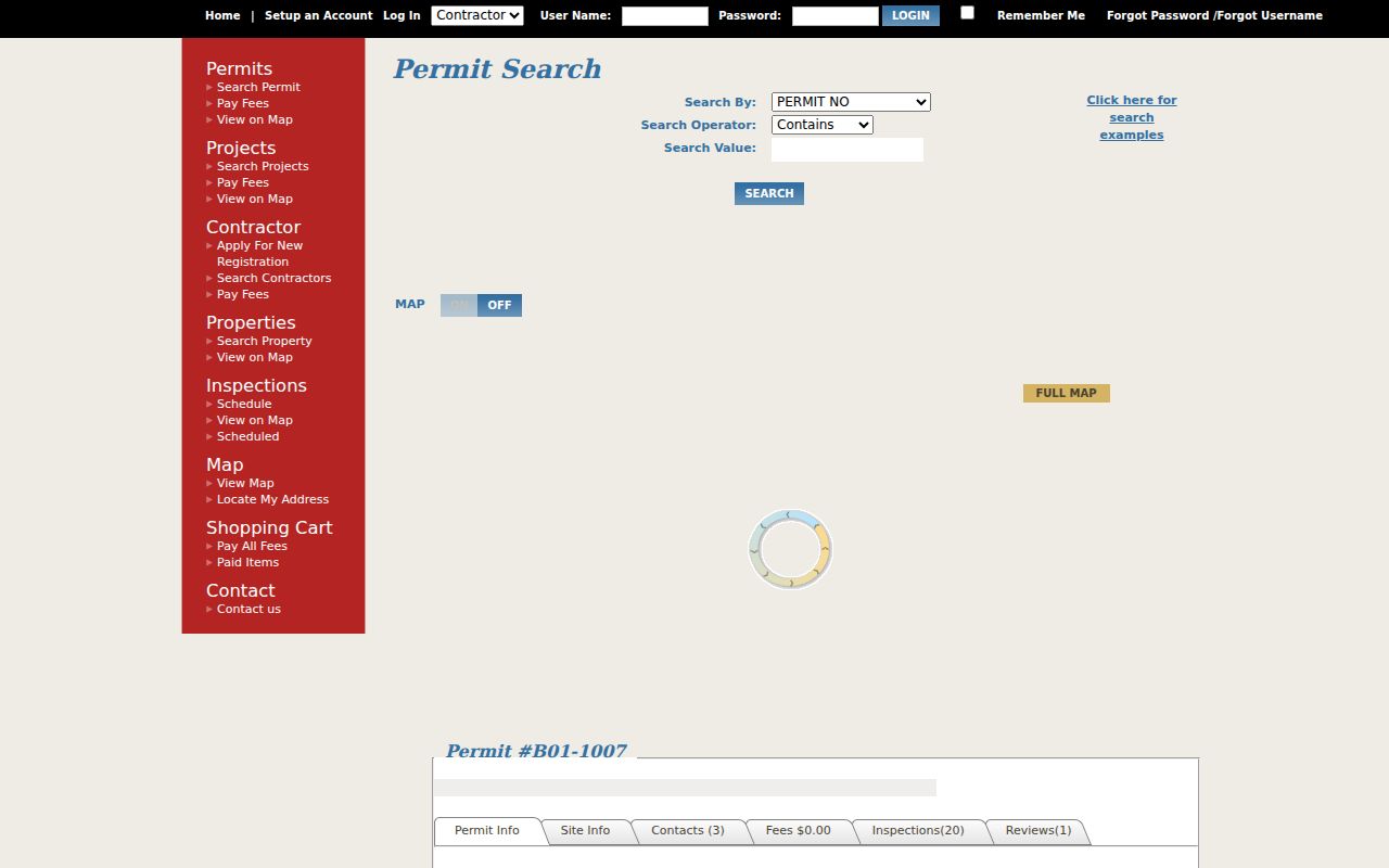
The permit view adds a dated project layer to a Frisco address, while the county clerk remains the source for a recorded transfer.
If the online record is incomplete, the City access sweep is eTRAKiT first, then a written and specific City Secretary public-information request, a call to the named division, a Municipal Center or court counter visit for municipal records, and Frisco Public Library or Frisco Heritage for older material. A public-information request asks for an existing document; it does not require the City to create a new list.
Frisco Deeds Along a Street
Use a legal-description-first approach for a Frisco deed chain. Search the current owner as grantee, compare the deed's legal description with CAD, open the purchase instrument, then search the seller as the earlier grantee or grantor. A street name in a deed may not match the present situs. Plats, replats, easements, and releases can explain why an address seems to vanish from a simple search.
Collin's historical guide covers 1843-1963 through an index-and-book workflow. It uses year buckets, a last-name letter, and SUB pages to reach the actual index page, then volume and page to view the historical book image. The current guide covers 1963 forward, though its older instructions say the default search date may begin later and needs narrowing. Denton-side Frisco records belong in the Denton Clerk's portal, where the guide calls for Index Only for grantor and grantee work, OCR for a name anywhere, date narrowing, and initials or alternate spellings.
Note: Record the instrument number or volume and page with the legal description, because a name match alone is not a reliable deed match.
Frisco Voter Records by Address
Collin's individual voter search is a narrow current verification route with first name, last name, and date of birth fields. Its live page showed an error during research, so it should not be presented as a complete address search. A full Collin voter-list request follows the Elections Store or written-request path. The county says its Excel export can include registered and mailing addresses, districts, registration date, status, and voter history, but not phone numbers or email. Denton-side voters require the Denton County Elections path.
Texas distinguishes public and confidential voter fields. Telephone, Social Security, driver-license, and personal-ID data are confidential. Protected voters can have their residential address withheld, and a public individual result is not a household roster. The County's list-use rules also restrict use. Check the Texas voter address confidentiality guidance before relying on a displayed or suppressed address.
Frisco Street History Clues
Older address work needs a different place-name lens. Frisco began as a railroad town in 1902 and was known as Emerson, then Frisco City, then Frisco. Residents and businesses moved from Lebanon and Erudia. Before rejecting an older record, search both counties and those historic labels alongside the name or legal description. Early Frisco residents may also be indexed under a county, neighboring community, or land description instead of the modern city name.
The Heritage Association identifies the Original Donation area with Maple Street to the north, Ash Street to the south, County Road to the east, and John Elliott to the west. That is a useful historic frame, not a boundary for today's city. No official source located a formally documented citywide Frisco street-renumbering year. Old maps and plats are the appropriate bridge when a historic address and a modern address do not line up.
For a dated address clue, the Frisco Heritage newsletter documents a December 1958 eight-page telephone directory, while Frisco Public Library, the Portal to Texas History, and the state library and Briscoe Center are the fallback chain for reverse or city-directory material. The historical collections themselves are described on the Frisco city directory page.
Limits of a Frisco Street Directory
Public address records do not reveal every person connected with a property. They leave out many renters, household members, guests, protected voters, utility customers, delivery recipients, and DMV registrants. Federal driver privacy rules restrict DMV address data. Utility and delivery customer lists are not public simply because a parcel is publicly mapped. A homestead exemption is evidence of a tax claim, not conclusive proof of current occupancy.
Online access also has practical limits. Collin CAD may be slow or unavailable during maintenance or high traffic, and its home page directs users to the Texas Open Data Portal or an alternate property search. For land records, the Collin County Clerk land-recordings page says House Bill 4350 redacted some information in certain instruments and warns that the online database is not the complete official repository. When the index is not enough, request or inspect the official instrument with the Clerk.
Lawful use. Frisco address records support personal, lawful research such as family or property history. Do not use them to stalk, harass, intimidate, or harm anyone.